Tag Archives: lizardpeninsular

A circular walk from Porthallow to Carne, following the river estuary through Gillan, returning on the coast path to Porthallow.

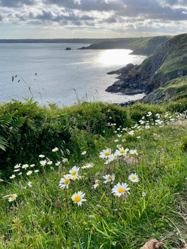
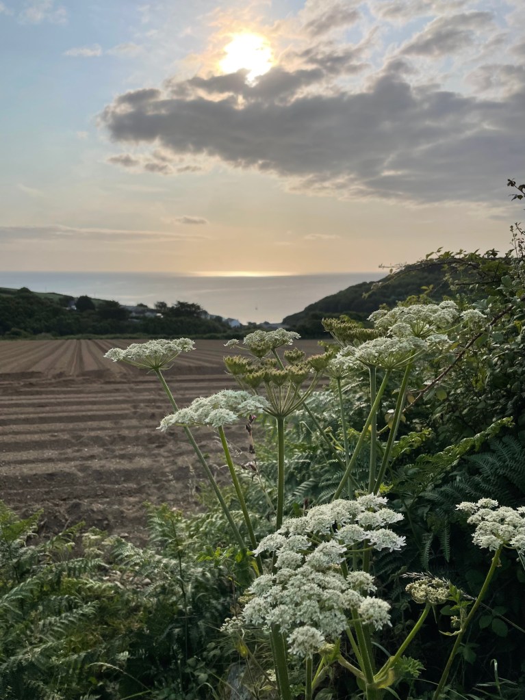
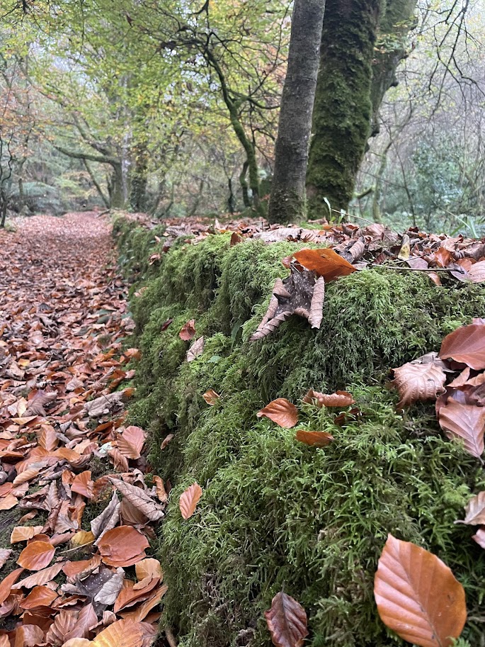
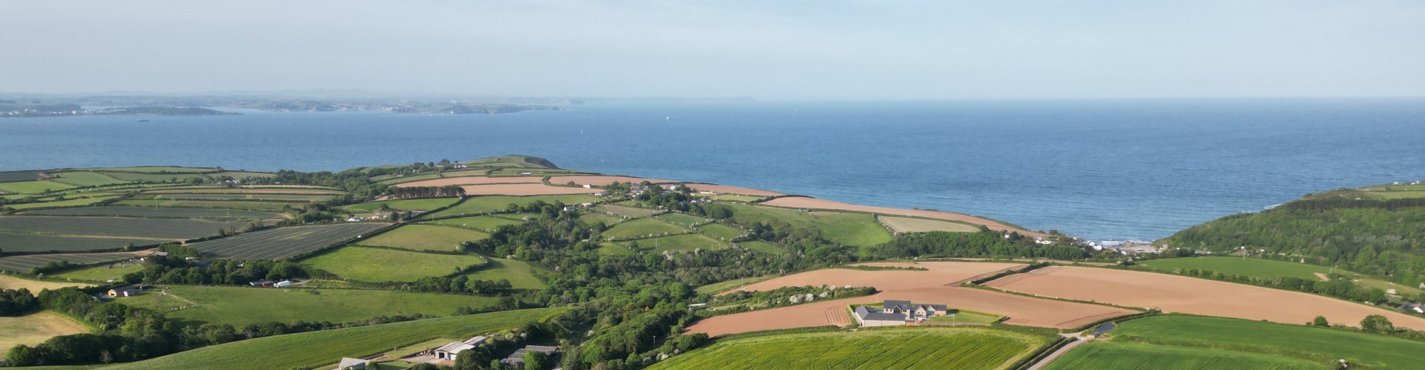
One of the many reasons this walk is so special is that the footpath guides you through a range of habitats and landscapes. Initially through a wooded valley, then crossing fields to Carne where you walk beside the river until it meets the sea, and then follow the coast back to Porthallow. There are also a few secluded beaches only reached on foot.

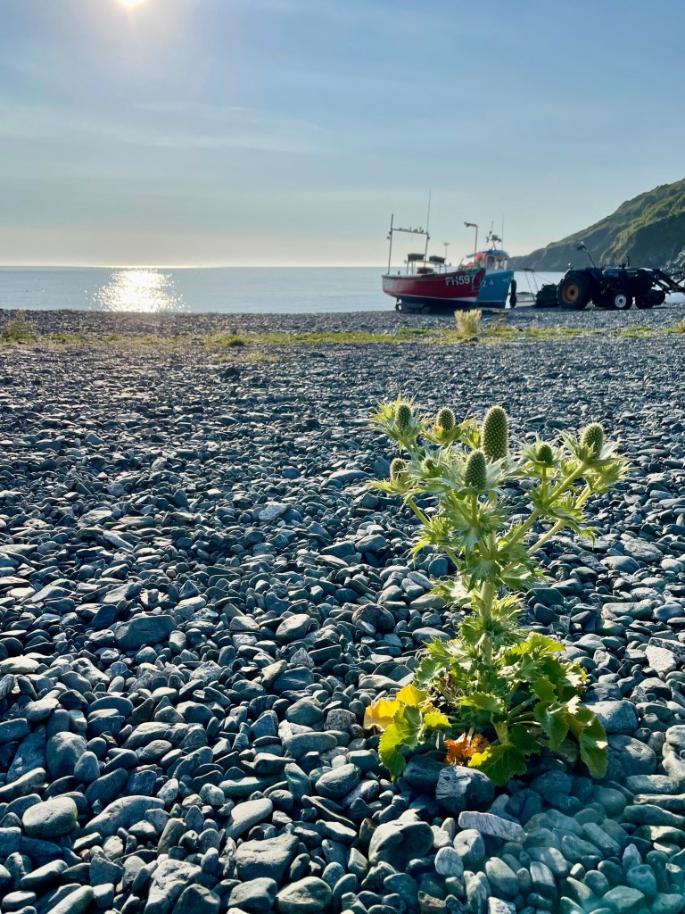
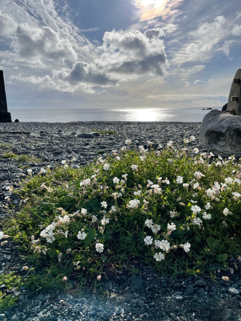
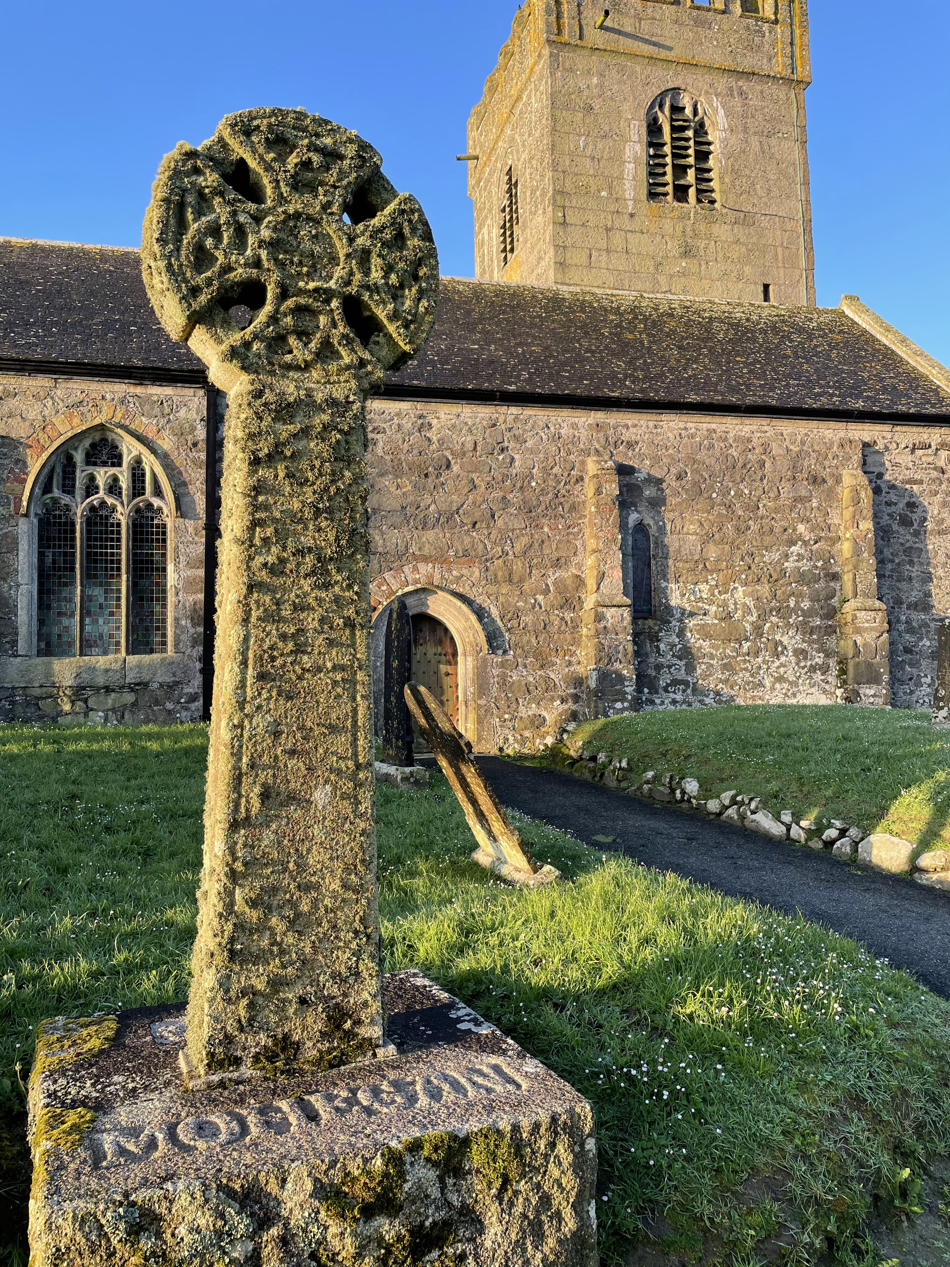
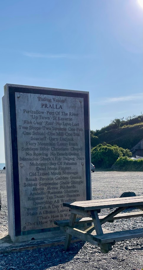
Situated at the top of Porthallow beach is the mid point marker for the Southwest Coast Path. This stone structure stands tall and displays engraved metal plates, on one side capturing the flora and fauna of the Lizard Peninsula, on the other side the ‘Fading Voices‘ of Pralla, the local name for Porthallow. The ‘Fading Voices‘ creates a written record of Cornish dialect, this was and is spoken language, often written by people from outside the area so the spellings are up for debate!

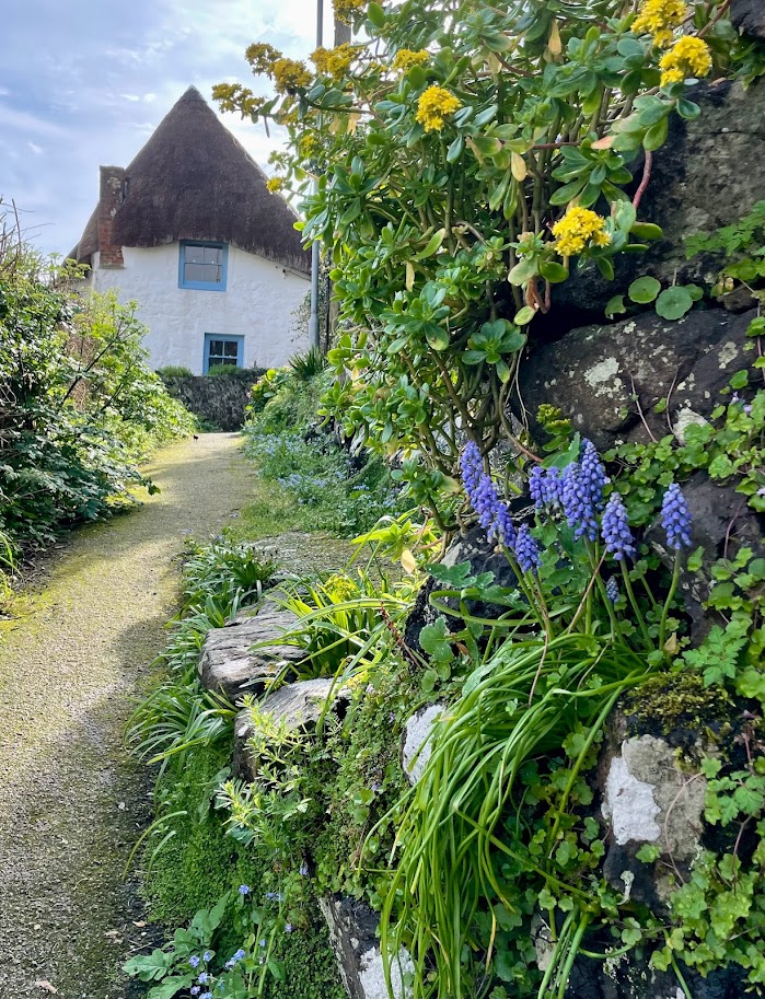
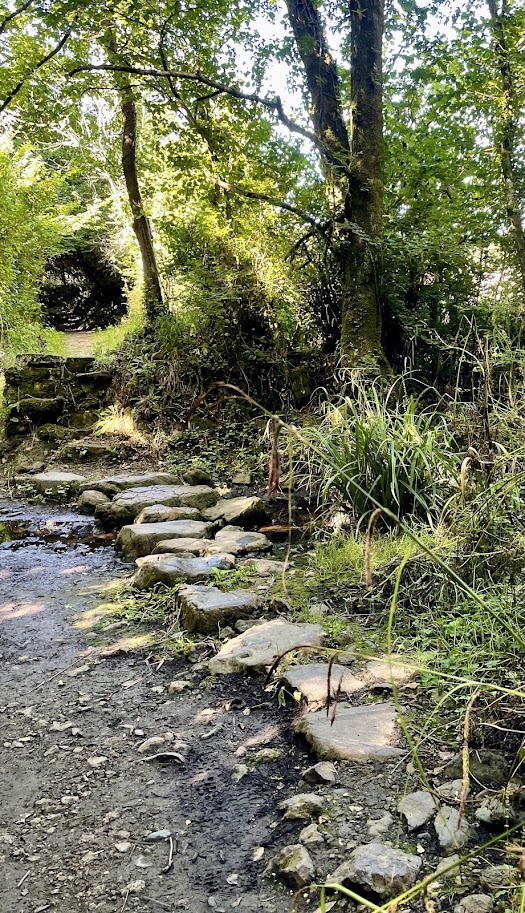
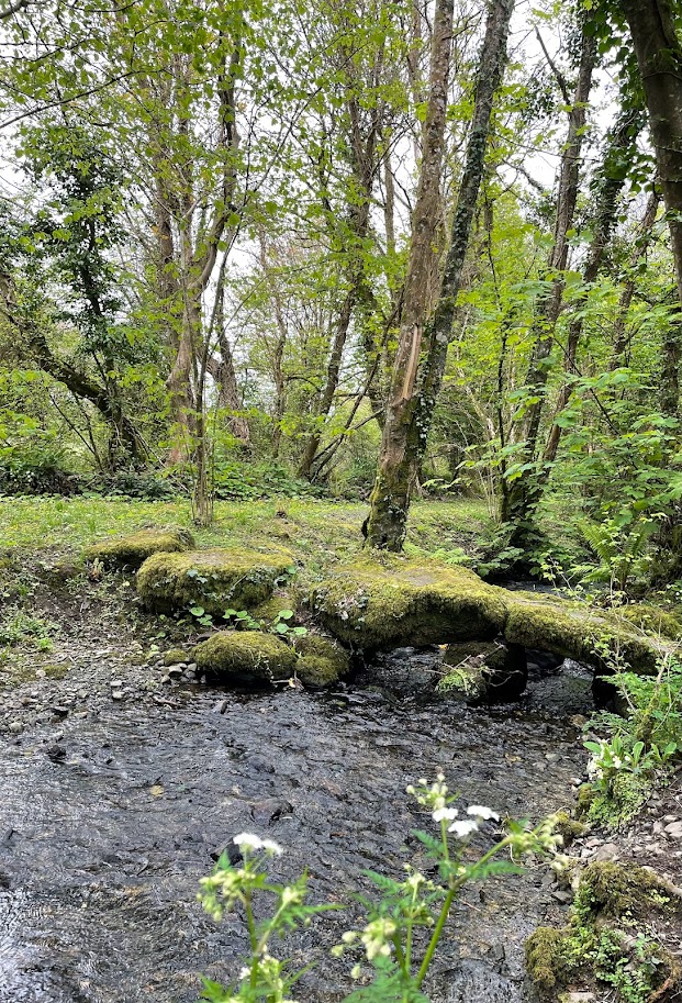
The walk starts heading inland, head up the beach and join the road heading right past the phone box, continue straight ahead past old cottages on your right. Follow the road around to the left for a short distance, before heading up hill take the lane on your right, walking between a terraced row of houses and their gardens on the opposite side of the path. Walk along this valley, initially wooded, across a field before a passing through a wooded area that leads to a wooden bridge and joins a lane heading up hill.

The hamlet of Treglossick comes into view, referred to locally as Ludjack, one of the words engraved on the mid point marker on Porthallow beach. Join the road and turn left, at the T junction turn left, just before a road joins from the left is a footpath on your right up a hedge that crosses several fields. Join a lane, turning left at the top as you reach the ancient hamlet of Trewothack. The footpath weaves around Trewothack, between two large farm sheds before joining a lane that leads you to more fields.

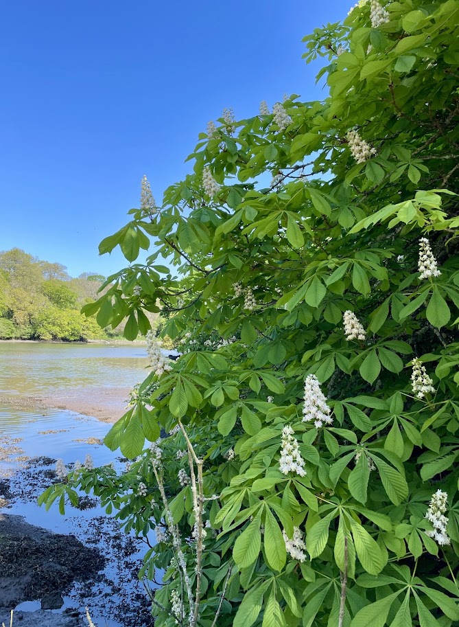
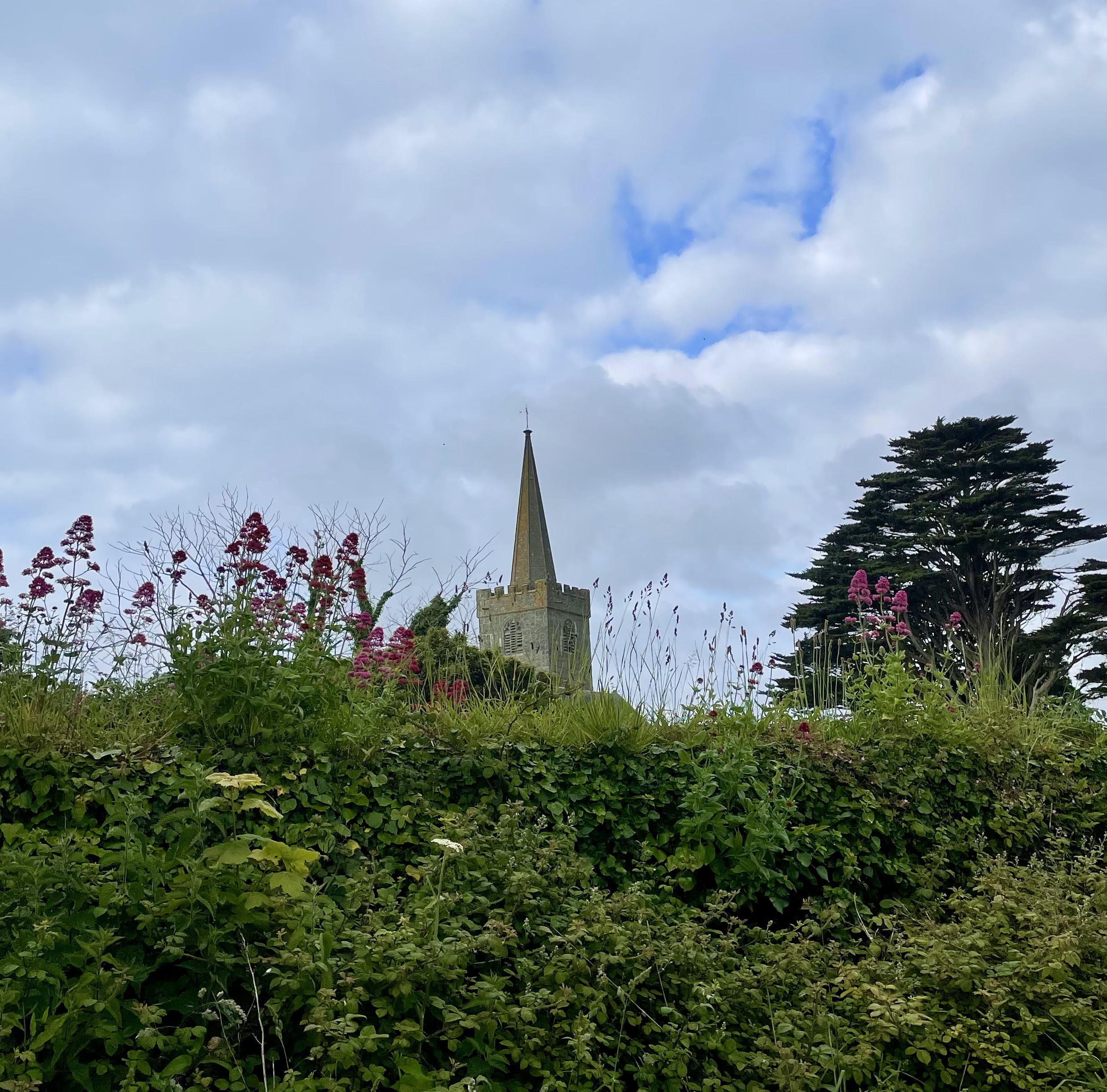
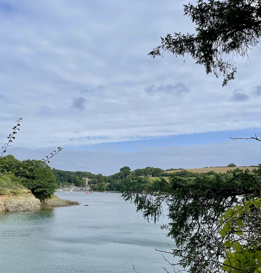
As you cross these fields and head down hill, in the distance on your left you can see the church tower of Manaccan nestled in the trees. On your right you get glimpses of Falmouth Bay in the distance. Join the road for a short distance heading downhill, taking the footpath on your right before the small bridge over the river as you enter Carne. Immediately the path takes you through the sweeping boughs of a magnificent horse chestnut tree. With boughs sweeping out over the river reflected on to the water this is a uniquely beautiful.

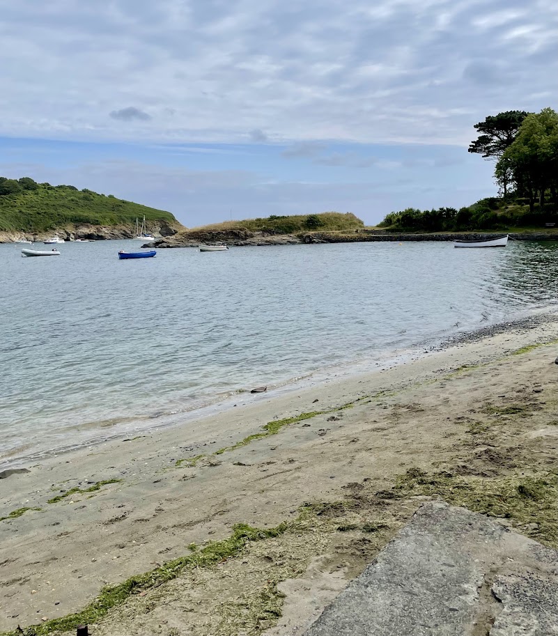
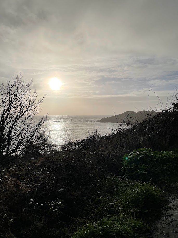
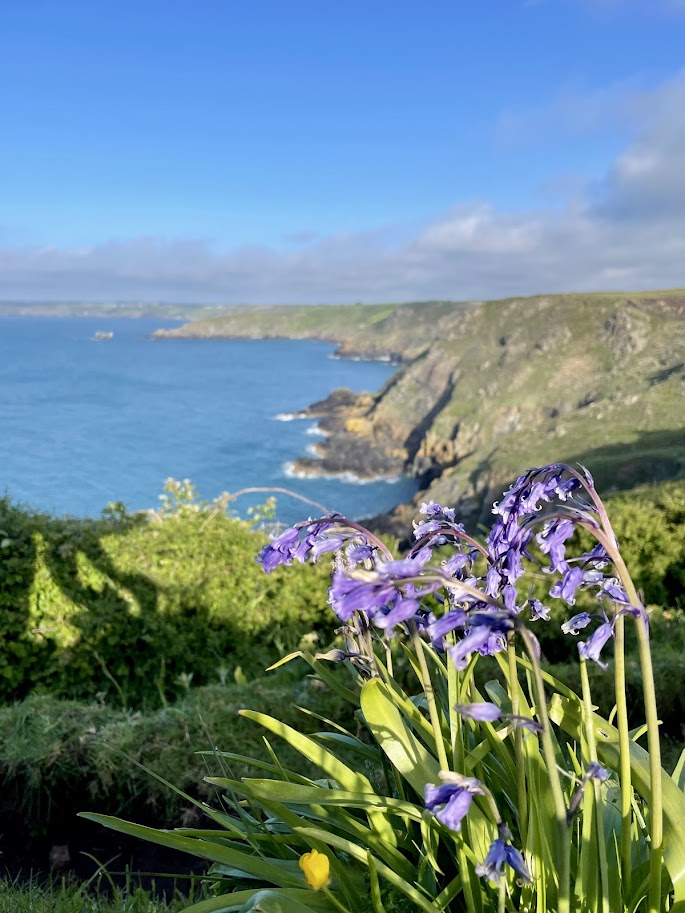
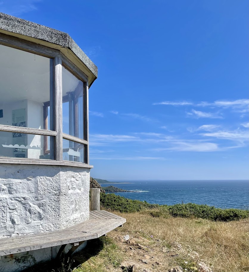
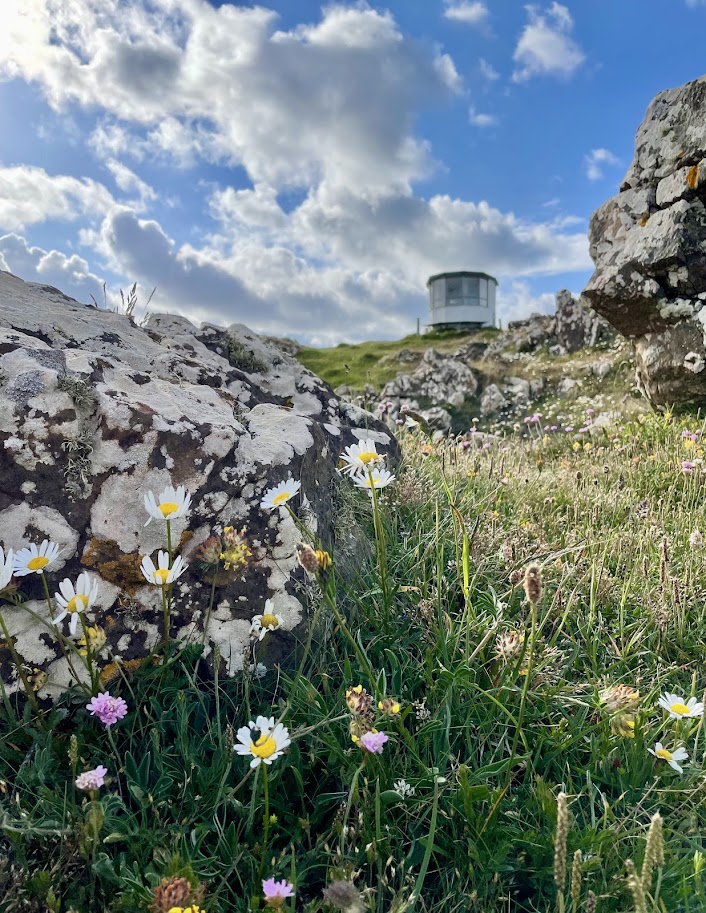
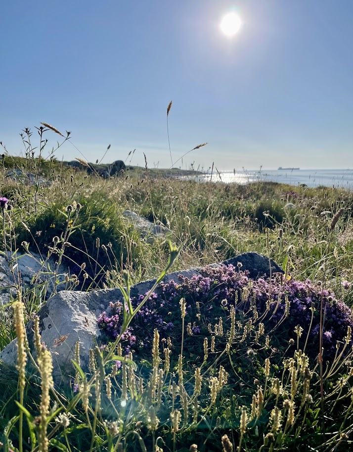
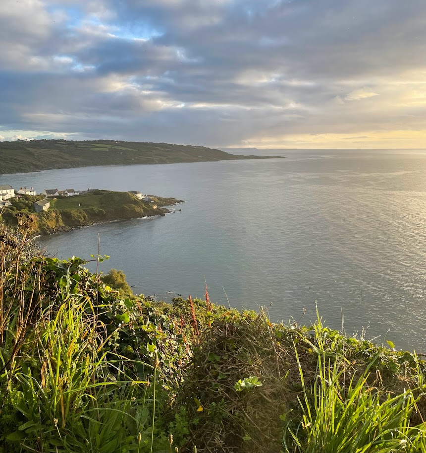
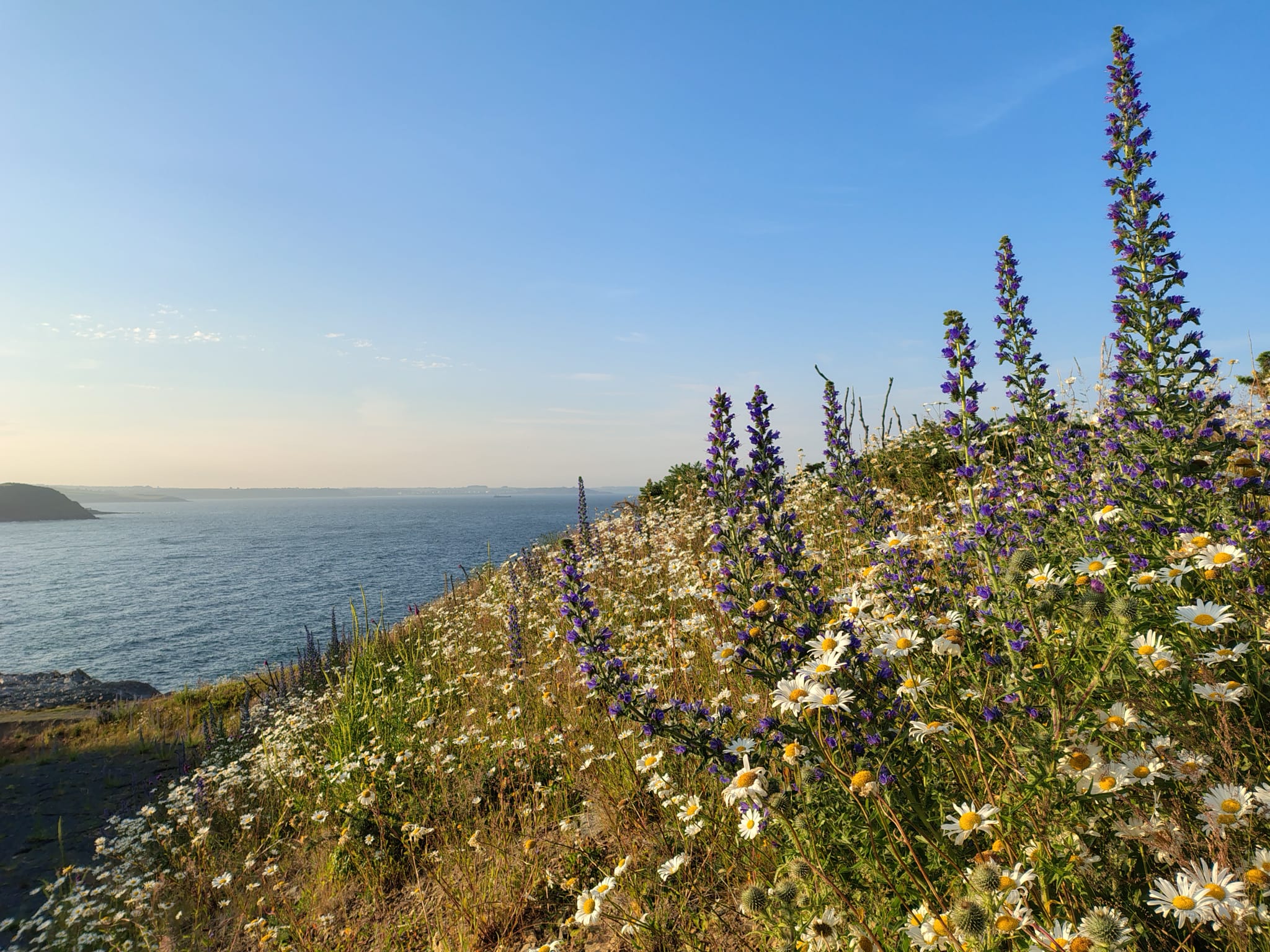
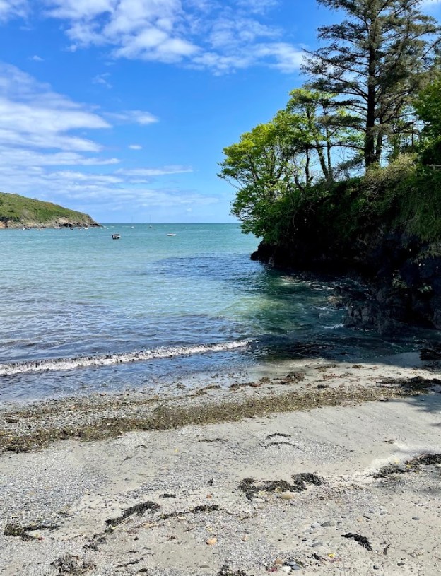
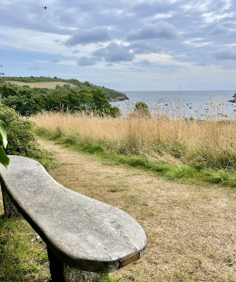
This path weaves it’s way along the wooded banks of Gillan estuary, eventually across the small sandy beach of Flushing before reaching Gillan’s sandy shores. Along the way are seats with stunning views and a remote feel. As you leave Flushing the path continues to follow the estuary, looking across to the opposite bank you can see the creek side church of St Anthony. At Gillan the small low headland called The Herra offers natural shelter, seating and a small shingle beach on the far side with views across to Falmouth. Return from The Herra and follow the path alongside a large garden, alongside the estuary eventually reaching Trewarnnevas cliffs that lead on to Nare Point Coastal Lookout Station.

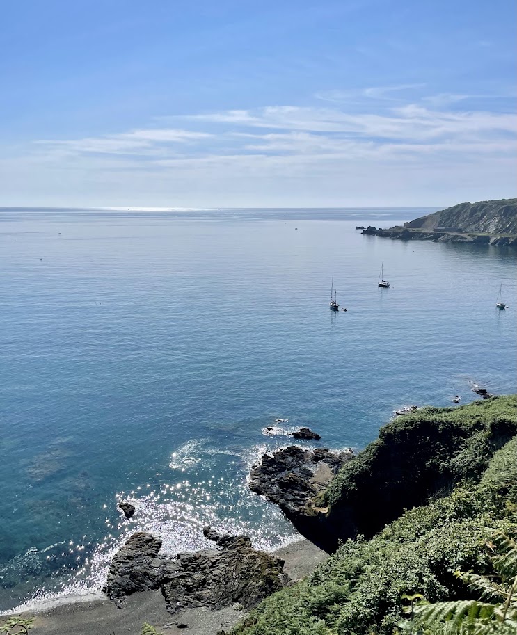
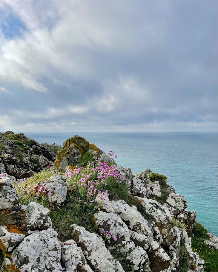
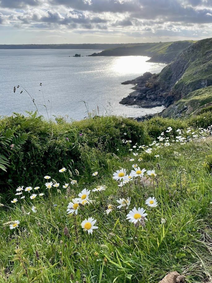
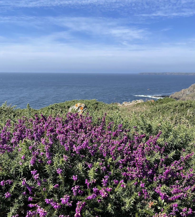
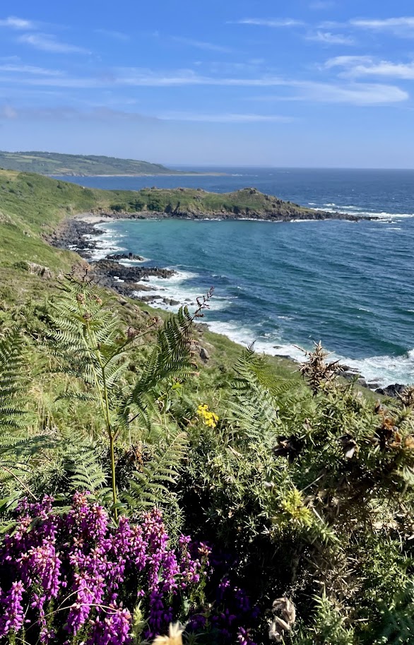
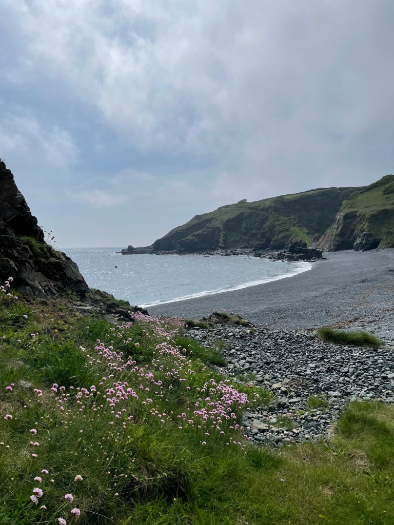
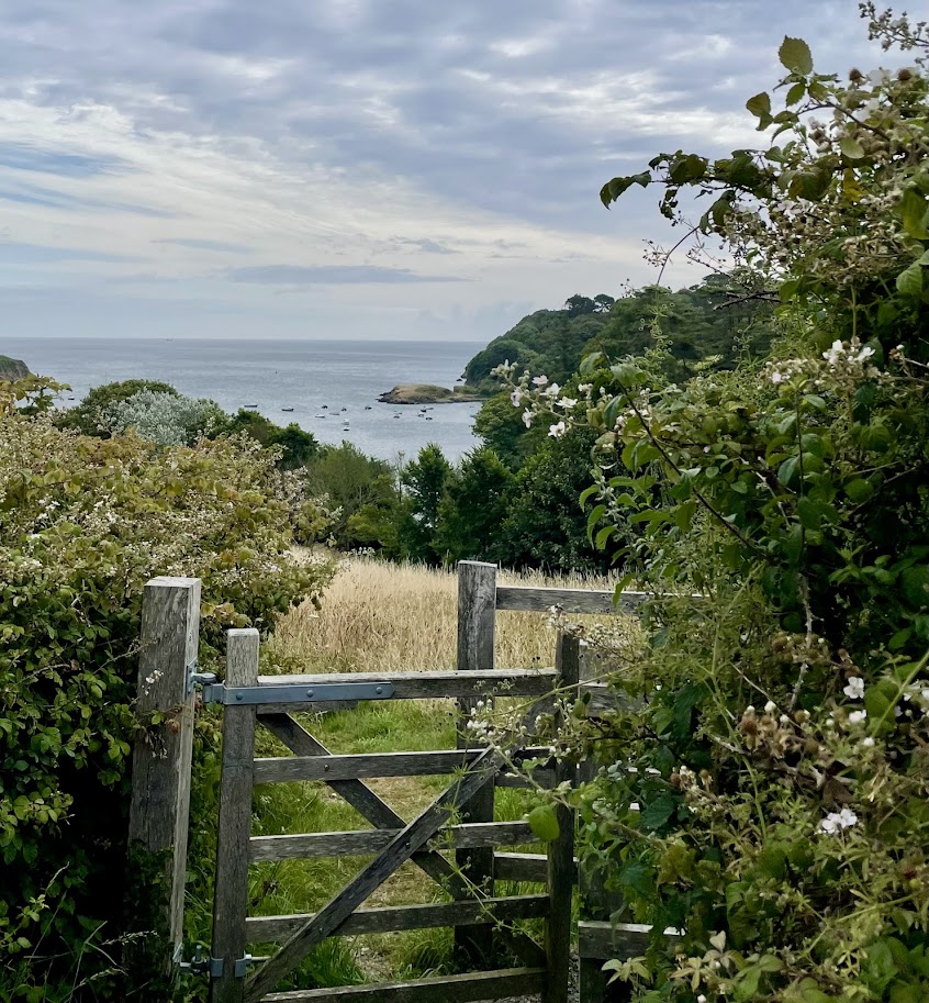
As you continue past Nare Head you notice a change in habitat to a coastal environment, follow the path above the sea to Porthallow.

The practicalities

Approximately 6.5 miles

Porthallow has honesty box car parking on the beach (cash or card), public toilets are on the beach.

Fat Apples is a short 300 meter walk up from the beach in Porthallow, with the sea behind you walk up the road on your left.

The New Inn, Manaccan could be a detour from Carne, rather than joining the footpath, continue along the road. Pass a road turn off to the left, after layby parking on your left there is a footpath on your right up through a wooded valley to Manaccan. On reaching the made up lane turn left, left again when you join the road. With the church on your right take the road left. Below a road off to the right is the The New Inn.

A circular walk from Coverack to Black Head

We began our walk from the pretty fishing village of Coverack, meandering along the sea front and up the hill, past the Church. As the road levels out and the pavement starts, cross the road and walk up the little lane at the left hand end of the grass bank. This lane is known locally as “The Gardens”, and has been used by generations of village children as a short cut to the village school at the top of hill.

Pass steps on your right, then take the right hand fork of the lane that joins the road opposite the old Wesleyan Chapel. Follow the road down hill and take the lane on the right, below the chapel that leads you in front of a row of old coastguard cottages. Stay on this lane to the top, up some steps and diagonally across a field. Spare a thought for coastguards of days gone by who did this route on foot and often in the dark! They were assisted by whitewashing stones at intervals along the path.

On joining the road, turn left in front of an old thatched farmhouse and modern bungalow. Follow the bungalow hedge, blue with flamboyant agapanthus flowers in summer. Take the path on the right, that weaves around. If you look closely you may see an old hand pump in the hedge on the right, stepping stones make it easier to cross the stream. Take the footpath immediately right over the wooden stile, head diagonally right across this field. Join the concrete road and turn right to the hamlet of Trewills, a huddle of old properties with some lovely colourful gardens. A short way past Trewillis there is a stile over the hedge on your left (you could continue on the road and take the next left). Take the footpath diagonally right across the field to the hamlet of Trelever, on joining the road turn left. Follow the road around to the right, this becomes a lane and eventually a footpath with sea views across to Lizard point, distinctive with Lizard lighthouse topping the headland.

Follow the coast path around to the left, as you emerge onto the headland if you look right you can see the sandy beaches of Kennack and Lankidden.

Ponies graze the headland to keep the foliage under control, allowing a host of wild flowers to flourish, different coloured flowers dominate depending on the season. Tiny delicate blue squill and bluebells in spring, shades of pink and purple heathers in summer to name but a few.

On the distant headland Black Head hut comes into view, when you are some way off. During the Napoleonic Wars a Naval Signal House was situated there, there is no evidence of the building’s stone walls. When WW1 coastal patrols were increasing there was no shelter on Black Head, in 1915 a purpose built Watch Hut was erected. For generations the Black Head has been used as a look out for shoals of pilchards, several spend there time carving their names and initials into the rocks. If you look closely several can still be found, dated from the 1870’s.

Once you pass Black Head you see views across Chynall’s Point, Lowland Point, Falmouth Bay and beyond. Continue along this path that runs along the cliff edge, before veering inland slightly beside the sculpture park and returning to the stepping stones across the stream used earlier in the walk. On joining the road turn right, walking downhill towards the old Headland Hotel, now apartments, take the path on the left before reaching them. Take the steps down and turn left towards Coverack, on this approach to Coverack you get good view of the Watch House perched on the cliff edge before The Paris. Strategically placed there in the late 18th century to house the local excise men to combat the smugglers. It was taken over in the 1820s by the Coastguard Service.

On joining the made up lane turn right in front of the coastguard cottages and walk down into the village, along the sea front to your starting point.

The practicalities:

Approximately 4.5 miles

Coverack has honesty box car parking – card or cash, public toilets are situated in the top car park. There are more public toilets by the harbour.

There are several lovely places to eat, including the Bay Hotel (dog friendly, set off the road above the beach with spectacular views) and The Loft, near the harbour.

The gift shops in the village sell many locally produced items and goods – The Old Mill Shop and The Seine Loft.

A circular walk from Tregarne along the new coast path between Porthallow and Porthoustock

We are very lucky to be in an area of outstanding natural beauty, with recently improved public access to many areas of the coast. This has been achieved by opening several new footpaths closer to the coast, allowing us to enjoy more wildlife habitats and get new views of the dramatic countryside and coast.

These new paths also provide greater options for circular walks, in addition to the more conventional South West Coast Path.

In 2025, a new stretch of coast path was opened between Porthallow and Porthoustock.

From Tregarne, either walk the quiet road or head across the footpath to Porthallow, and join the South West Coast Path as it climbs steeply out of Porthallow on the right side of the beach as you are looking out to sea.

As you reach the top of the hill, you get sweeping views across Falmouth Bay. Now you have the option to turn left after a wooden stile and walk above the sea to Porthkerris, passing in front of The Sea Salt factory. Here, salt production is still inspired by the original methods of harvesting the goodness of the sea.  The factory is not open to the public but their products can be purchased online.

Goats sometimes accompany you along this stretch of path! The next cove you come to is Porthkerris, here there is a dive centre and beach cafe. You cross the shingle beach; the footpath climbs the cliff at the far side providing spectacular sea views all the way to the pretty cove of Porthoustock.

With the sea behind you head to the road and follow it right for a short distance. Take the footpath in front of the old terrace of houses, enjoy their flora gardens and quaint thatched roofed cottages.

After you reach the quiet road that runs through Trenoweth Mill, you follow the path beside the stream up the tranquil shaded valley, lined with beech trees and moss.

As you follow the path across fields, you will notice the spire of St Keverne Church. The graveyard includes mass graves for many shipwrecks, including The Mohegan. Keep to the right as you pass through St Keverne square, the footpath takes the lane on the right down hill pass the village hall. As you cross the stream you can see the much older stone bridge, covered in moss on the right. Follow the path up hill and cross a few fields, from here there are spectacular countryside views and distant views of Falmouth Bay.

Depending on where you join the road, either follow it a short distance to the right, or cross it and follow the quiet road signposted to Tregarne. The road crosses the stream at Tregarne Mill, pass the house and take the lane that runs behind the house on the right. From here you cross fields for the final climb up to Tregarne. It’s worth resting and looking behind you for distant views of St Keverne.

The practicalities!
This circular walk could commence at Porthallow, Porthoustock or St Keverne, all these villages have honesty box car parking (cash only in St Keverne and Porthoustock) and public toilets.

There are places to eat in St Keverne (two dog friendly pubs). Seasonally opening eateries that are dog friendly – Porthallow (Fat Apples cafe 5 minutes walk up the road past the Cellar Marine), Porthkerris Beach Cafe, Porthoustock has a food van on the beach.

Porthallow, Porthkerris and Porthoustock beaches are all dog friendly shingle beaches.

The walk is approximately 5.5 miles